


The Mariinsky Post on the Amur - Journal of the Ministry of Internal Affairs, 1861
Translation about a Russian outpost on the lower Amur River near the Pacific Ocean

Translator’s Introduction
Below is a short article about the Mariinsky Post, a small Russian settlement on the lower Amur River, strategically located near the Pacific Ocean and Sakhalin Island. The post was founded in 1853, just prior to the region’s formal annexation to the Russian Empire in 1858 and 1860 following the treaties of Aigun and Peking. Prior to this, the region of what is today the Russian Far East was apart of China’s Qing Dynasty. Sparsely settled and of marginal importance to the Qing, the region was given to Russia in exchange for Russian diplomatic support against Britain and France during the Second Opium War and the Taiping Rebellion.

The Mariinsky Post today forms two neighboring settlements. The first is known simply as Mariinskoe and hosts a population of approximately 500 people. The second is the Mariinsky Port, which has about 300 people. They are located within Khabarovsk Krai.
For more on the Russian annexation of the Far East region, I would highly recommend “Imperial Visions: Nationalist Imagination and Geographical Expansion in the Russian Far East, 1840–1865” by Mark Bassin. For a good book on the history of the Russian Far East, I would recommend “The Russian Far East: A History” by John Stephan.
This article was originally published by the Journal of the Ministry of Internal Affairs, which was the organ of the Russian Empire which managed law enforcement, censorship and other similar matters. The journal was published monthly from 1826 to 1861, when it was replaced by the “Northern Postal,” which was published daily. The author is unknown. The source for this translation can be found here.
Lastly, my book “The Expedition to Khiva” is available on Amazon! Get it now!!!


The Mariinsky Post on the Amur
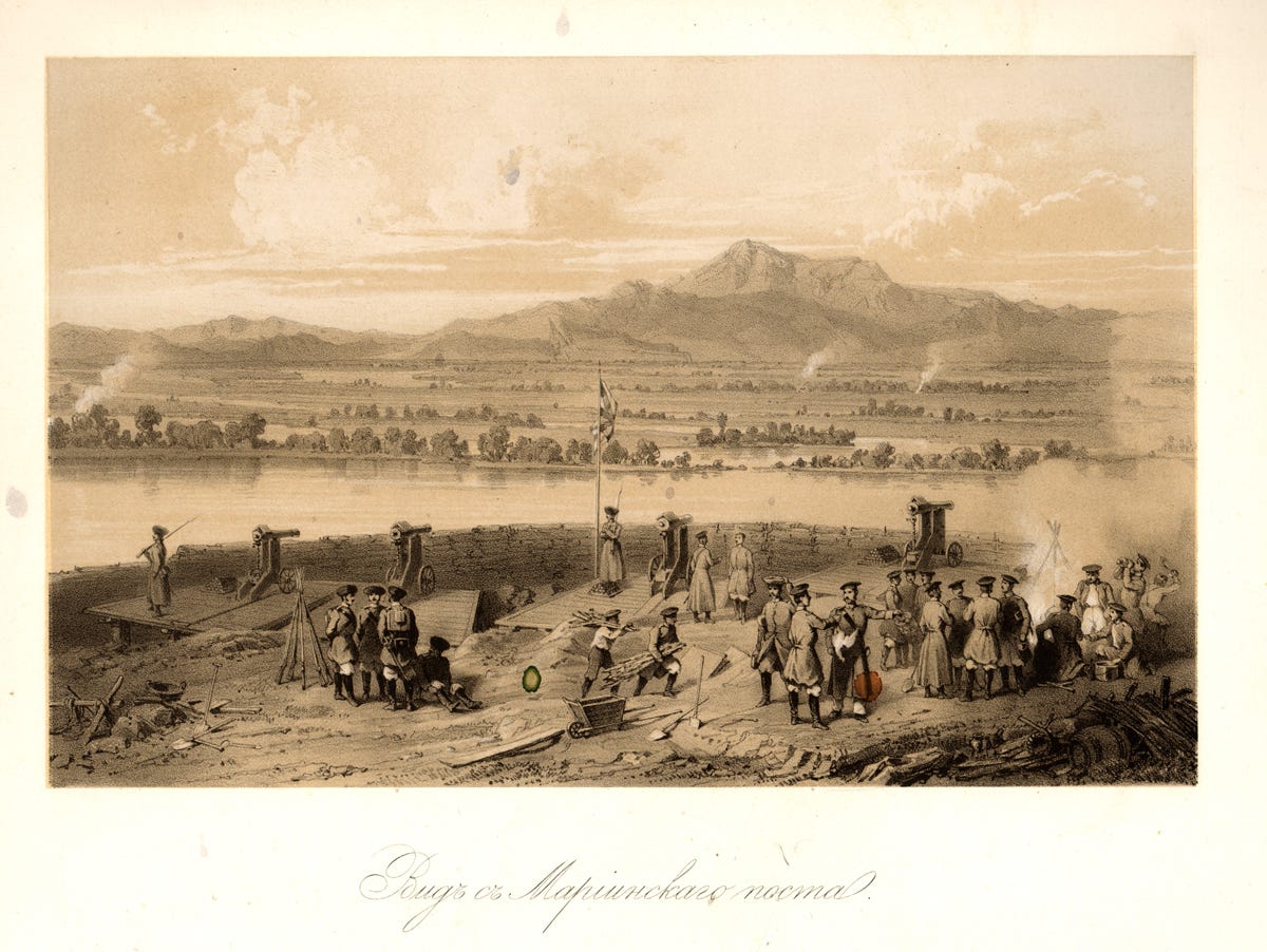
The Mariinsky Post is located on the right bank of the Amur, 237 verstas1 from the city of Nikolaevsk, in a low valley between mountains and bordered by Lake Kizi. Near to the sea, these mountains join with the Sikhote-Alin range and the Nyangmar Mountains. With its proximity to the Bay of De-Kastri and thank to the convenience of communications from this bay across Lake Kizi, the strategic significance of this point was recognized as being very important during the last war.2 Therefore, in 1855, the founding of Mariinsk was marked by the building of a house for the governor, a barracks, a provisions storehouse and other warehouses. In 1858 and 1859 a wooden church was built by the Amur company and a few private and state homes were later added. All of these structure formed a slightly bent line, in the middle of which stood the church. The site occupied by Mariinsk is damp and swampy; it is also surrounded by land that is not particularly convenient for farming, thus Mariinsky will remain a purely military post. Below it, at a distance of one versta, is the village of Kizi, which consists of a dozen good looking homes which forms a single street. In 1859 this village was nearly merged with Mariinsk. The residents of Kizi are earnest gardeners; during harvest time gardens provide them with a decent profit. In spring, a pood3 of potatoes sells for 3 silver rubles; in autumn the price drops to 1 ruble and 25 kopeks silver. The traders here are Americans who travel from Nikolaevsk, a few Siberian merchants and one Jew, who is also a watch maker and goldsmith.
Old unit of Russian measurement. 1 versta is equal to 1.06 kilometers or 3,500 feet.
That being the Crimean War from 1853 to 1856.
Old unit of Russian measurement. 1 pood equals 16.38 kilograms or 36.12 pounds.
What would Americans be looking to trade for? Plenty of furs in North America. Can’t think of what else in this era.