The River Ili - Nikolai Abramov, 1860
Translation on the history and geography of the Ili River
Preliminary note: For Gmail readers, this essay might be clipped due to size limitations. To read the entire essay simply click on “View entire message” at the bottom of the email, thanks.
Translator’s Introduction
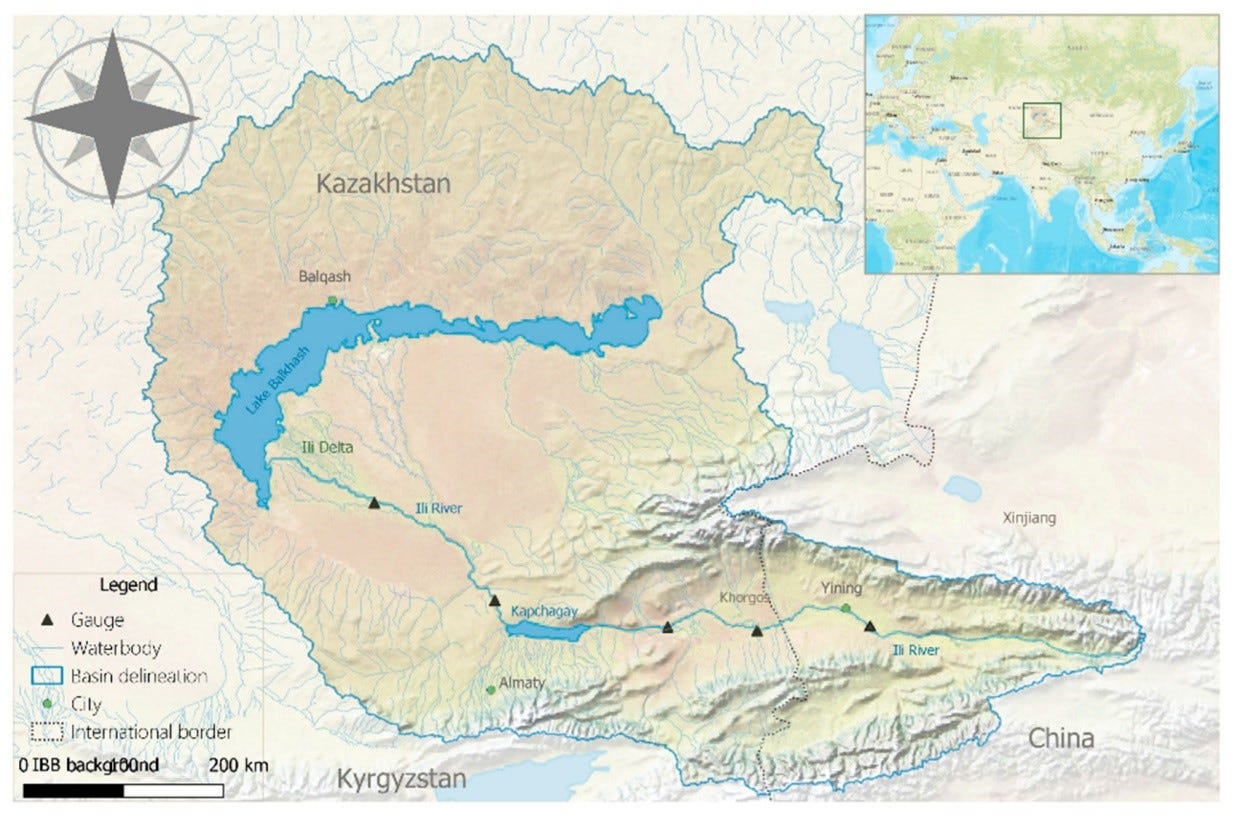
Below is a translation of a newspaper article about the River Ili, one of the great rivers of Central Asia that for all of recorded history hosted great nomadic peoples, from the Yuezhi, Turks, Qarakhanids, Qara-Khitan, and then various Mongolian and Kazakh hordes. The Ili River begins in the Tianshan Mountains in the modern day province of China, Xinjiang, and flows westwards before draining into Lake Balkhash. Seven large rivers form the drainage basin of Lake Balkhash with the Ili being the largest, and collectively this region is known in Turkic as Zhetysu and as Semireche in Russian, both meaning “Seven Rivers.” This region includes both the southeastern corner of modern Kazakhstan, as well as the Chu Valley of modern Kyrgyzstan, the small sliver of its territory located north of the Tianshan Mountains were its capital Bishkek can be found.
Historically this region was largely home to nomads, but there were always also settlements built there by Sogdians which were meant primarily to be commerical centers where the mercantile Sogdians could interface with the nomads. Suyab on the Chu River in modern day Kyrgyzstan was the most noteworthy of these urban centers, which also served as the capital of the Western Turkic Khaganate prior to its destruction by the Tang Dynasty in the mid 7th century. There was also Alamliq located further up stream near the modern Chinese city of Ili, and Balasagun which was built later, also in the Chu valley near former Suyab. Aside from grave sites and other minor ruins, all that remains of Sogdian civilization in Semireche is the Burana Tower of former Balasagun near Tokmak in Kyrgyzstan.
The Russian conquest and colonization of the Ili and Semireche in the 1850’s represented a turning point in the region’s history, sedentary life had won out over nomadism. Verny, known day as Almaty, was founded in 1854, and Russian settlers subsequently flooded in and eventually even the Kazakh themselves sedentarized and urbanized.
As is alluded to already, the history of this region is kade up of cycles of one nomadic people conquering, displacing and absorbing an other. This endless cycle eventually culminated with the Russian conquest, and if history had played out differently they might have fully displaced the Kazakhs from the region, or they themselves been displaced by the Germans or someone else. And often when displaced, the nomadic group would migrate elsewhere displacing another group in turn, creating a billiard ball effect that at time reverberated across the entirely of the Eurasian steppes. Aside from the river itself, this endless cycle nomadic powers displacing one another is the main theme of this article.
The author of this text, Nikolai Alekseevich Abramov, was born in Kurgan, south of Tobolsk in Siberia, in 1812. After studying in a seminary where he learned Tatar (a Turkic language), he became a renowned ethnographer of Central Asia and published numerous works. He also served as a state advisor to the Western Siberian Governor General Gustav Grasford (as far as I know Abramov had no involvement with Grasford’s strange plan (see link)). This article was original published in the Tobolsk Guberniya Vedomosti, a newspaper based in Tobolsk, Russia’s first capital of Siberia. The newspaper was published bi-weekly, and ran from 1857 to December 1918. The source for this translation can be found here. The original text can be found here.
For further reading on this region, its history and the cycles of nomadic migrations, I would suggest “China in Central Asia: The early stage, 125 B.C.-A.D. 23: An Annotated Translation of Chapters 61 and 96 of The history of the Former Han Dynasty” by A.F.P. Hulsewé, “Empires of the Silk Road” by Christopher Beckwith, “The Barbarian Empires of the Steppes” by Kenneth W. Harl with The Great Courses, and for the Zungars in particular, alongside “China Marches West” by Peter Perdue and “Where Two Worlds Met” by Michael Khodarkovsky, I have several other translations about Zungars already published.
The River Ili
The River Ili is located in the Semipalantisk oblast1 and is one of the most remarkable rivers in Central Asia. Since the most distant time the Ili region has been inhabited by different peoples who replaced each other one after another. As indicated by Chinese chronicles, this region was already known in the 3rd century before the birth of Christ. At that time the region was inhabited by the Se people, and then the Yuezhi. In 177 BC the Huns expanded from the Gobi and Huang He2 far into the west and displaced Yuezhi and Wusun from the Ili region who had been previously living there, just as the Wusun had displaced the Se people before them. Then the Wusun again settled in the Ili and reached a state of strength and power. According to the Chinese chronicles, their numbers reached up to 630,000 people. In the 4th century AD, the Wusun, pressed by the growing strength of the Xianbei from the east, were forced to leave the Ili region, [Klaproth. Tabl. histor. de l’Asie. 105, 164.], with a part of them fleeing to the upper reaches of the Jaxartes (Syr Darya) and Transoxiana, and another group went to the Kyrgyz3 steppes towards the Irtysh. In 619 the Wusun submitted to the Turks, seemingly mixing with them, and thus disappearing from the theater of history [Землеведение Азии, Риттера. Т. 2. Перев. Семенова. Стр. 128—130.].
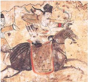
The Turk-Uyghurs from Orkhon and the Selenga reached the River Ili and Lake Balkhash in the the north-west of Zungaria4 [Klaproth. Tabl. histor. de l’Asie. P. 125.]. After various transitions and replacements of peoples, the Mongolian tribal grouping of Elyuts emerged in Zungaria. The Manchus called them Urats, in Mongolian - Oirats. According to the names of four brothers they were divided into four tribes: Zungar, Torgut, Khoshot and Durbot. A favourite gathering place of their hordes, around the permanent tents of the kokhans, were the pastures from Barkol to Ili to Urumqi [Klaproth в Magas. Asiat. Tom. II. P. 187.], while the fourth tribe of the Elyuts where named Zungars and had their own nomadic lands on the Ili. The Zungar Khanate was destroyed by the Chinese in 1758. [Тоб. губ. вед. 1857 г. Ч. неоф. № 27. Стр. 248—250.] After this the Zungaria steppes were emptied until the Kalmyks under Ubashi-Khan departed from the Urals for his former nomadic lands and occupied the current Semireche and Trans-Ili regions. Since this time, the Torgouts (a Kalmyk clan) have nomadized in the Trans-Ili region and on the right side of the river Ili, and the Big Kyrgyz Horde formerly nomadized along the Telas and further up to Tashkent. Under the leadership of Ablai Khan, these Kyrgyz moved to the east and after a successful and prolonged struggle they displaced the Torgouts, pushing them beyond the Little Alatau Mountains and occupied all of their lands. Since 1824 the Big Horde has been considered to be under Russian patronage, and in 1846 it accepted its position as a subject of Russia. Every year in the blessed Trans-Ili region Russian peasants and Cossacks of the Siberian Line Cossack Force are resettled (the first Russian settlers beyond the Ili reached there in 1854). The fortress of Verny5 and a few Russian villages are located there; in 1859 the fort Kastek was founded 80 verstas6 to the west of Verny [Вестник И. Р. Г. общества за 1860 г. Книж. 4. Отчет о результатах Иссык-Кульской экспедиции, Голубева.].
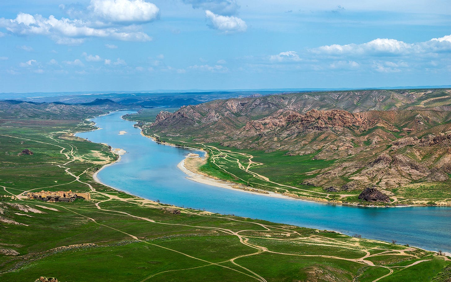
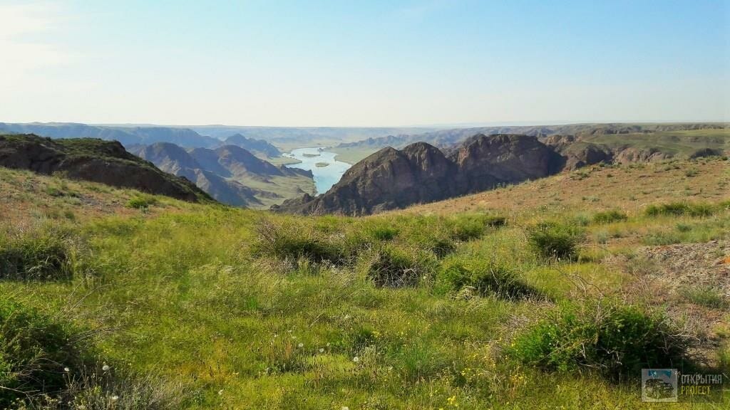
The River Ili, from which the Trans-Ili region receives its name, is made up of three streams: the Tekes, Kash-gol and Kunges. This first and most important river flows from the northern slopes of Mustag, in the Tekes and Talki mountains, and flows to the east before joining with the Kunges. Upon the the three rivers joining, the river recives the name Ili, and then flows 200 verstas to the Chinese city of Kuldja [Дневные записки переводчика Путимцова, в проезд его от Бухтарминской крепости до китайского города Кульджи в 1811 году.], and then flows through Chinese and Russian territories for another 600 verstas until it drains into Lake Balkhash with three different mouths, between which Kyrgyz nomadize and spans a distance of 8 verstas. The Ili flows from the east to the west along a wide valley that is 150 verstas in width. Due to the significant downhill slope towards Balkhash and the abundance of water from the snow of the Alatau Mountains, the course of the Ili is quick and around the Ili piket7 it flows at 4.5 verstas per hour, but where its shore is pressed by mountains, it flows even quicker.
The river’s waterway regularly changes, depending on the position of the river bed, as well as the time of year and temperature of the air. According to measurements taken in 1855 and 1856 during the high water period, in the area of 100 verstas from the Ili piket, the deep reaches up to 2.5 sazhens.8 In generally it should be noted that its deep ranges from 7 to 1.75 arshins.9 The bottom of the river is uneven with different layers of soil, and also due to the quickness of its surface water and its swirling flow. The shore is partially clay, in some places high and steep, especially on the right bank; the left bank is in large part low, sandy and saline in places, covered with a special kind of poplar (Populatus pruinosa), Russian olive (Eleagnus angustifolia), chingel (Halimodendron), white willow, thallus, saxual (Anabasis ammodendron), ash (Flaxinus sp.), rose barberry and others. The width of the Ili is up to 180 sazhens. The Ili raises at the end of February or beginning of March, and lowers at the end of November or beginning of December, or sometimes later. Spring floods occur in June, and are not very major, only occurring along the left bank. The water level lowers by the end of July. In September and October fords are formed for large cattle, and the well known ones are at Uguz-utkel (bull ford) between the mouths of the Chilik and Turgen, at Kyz-kichu, or Kyz-utkel (maiden ford), between Issyk and Talgar, a bit below the confluence with the Chinguldy on the right bank, and Tamgal-utkel near Tamgal-tash (stone with inscription).
Within Russia’s frontiers, in other words, beginning from the chain of Chinese pikets, the Ili on its right side takes in the rivers: Tugurek, which originates in the Uch-kuyandy and Chingildy mountains. On the left from Kungri-alatau it takes in the rivers: Charyn, Chilek Chabdar, Turgen which gets lost in the salt fields, sand and reeds around Ili, Issyk, Talgar, Kockelen with its tributaries the Big, Middle and Little Almaty (Apple), Aksau, Chamolgam, Kurtu, which does not reach the Ili and is lost in the sand, and Kupu.10 In the mountains these streams form beautiful waterfalls, especially the river Issyk, which has a magnificient waterfall of 45 sazhens, located 45 verstas from the fortress of Verny.
In the River Ili, Talgar and other streams there are fish such as: marinka, diptychus which are the same bred as trout, with the only difference being that the latter has red dots while the diptychus has black ones.. The Kyrgyz say that there are catfish in the Ili.
Semipalantisk was Russia’s main fortress on the Irtysh River in southern Siberia that faced the eastern Kazakh steppes. In 1867 the Semireche region was split from it and made into its own oblast
Chinese name for the Yellow River
This refers to modern Kazakhs. Russians than called Kazakhs as Kyrgyz while Kyrgyz were called Kara-Kyrgyz or Wild-Stone Kyrgyz
A reference to the territory of the later Zungar Mongols
Modern day Almaty
Old Russian unit of measurement. 1 versta equals 1.06 kilometer or 3,500 feet
Akin to an outpost or forward post that is meant to alert the larger settlements in case of attack
Old Russian unit of measurement. 1 sazhen equals 2.13 meters or 7 feet
Old Russian unit of measurement. 1 arshin equals 71.12 centimeters or 2.33 feet
This is a very awkward run on sentance that is difficult to translate precisely. The original says: В русских пределах, т. е. от цепи китайских пикетов, Или с правой стороны принимает речки: Тугурек, берущий начало в горах Учь-куянды и Чингильду; а с левой от Кунги-Алатау: Чарын, Чилек, Чабдар, Тургень, теряющиеся в солонцах, песках и камышах около Или, Иссык, Талгар, Коскелен с притоками его, с левой стороны Большой, Средний и Малой Алматты (Яблочная), Аксай, Чамолгам, Курту, не доходящие до Или и теряющиеся в песку, и Купу.







Needs editing: there are several glaring spelling and other errors
Could interest you.
God Favours Russia . . .
https://les7eb.substack.com/p/ukraine-long-proxy-war-vi-god-favours
The writing was on the wall.
_____
Most recently - The Political Economy of Genocide.
https://les7eb.substack.com/p/genocide-and-economics
_____
All essays - https://les7eb.substack.com
Free to subscribe . . .